Hi Stereolabs team,
I am using a ZED 2i camera with a ZED Box Mini, running SDK 5.3.0, for an outdoor quadruped robot mapping and localisation project. The previous connection problem has now been solved, and the ZED 2i can run outdoors properly. I recorded and ran the positional tracking during an outdoor robot test (refer to the csv file). The recorded data includes position, quaternion rotation, timestamp, and tracking state.
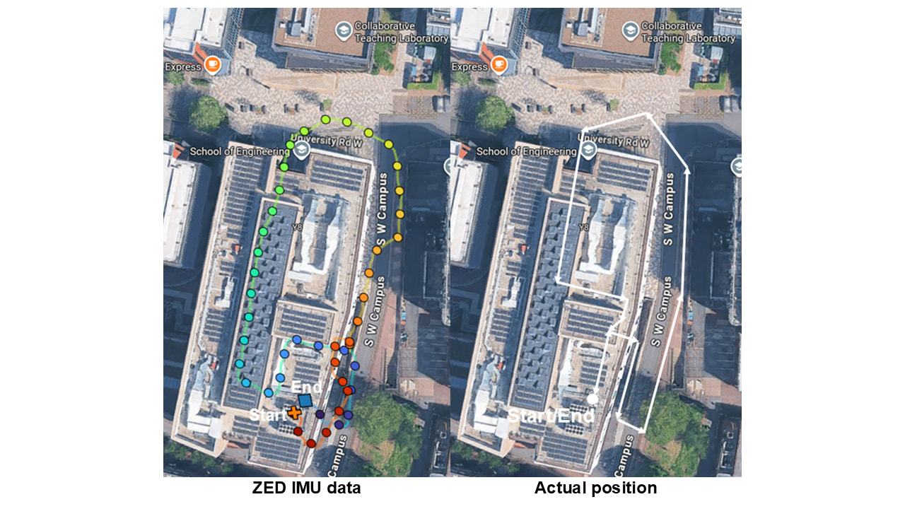
I converted the ZED position data into a 2D top-down pathway (see the HTML document) and overlaid it on a Google Maps screenshot to compare the ZED trajectory with the actual robot route. The tracking state was reported as OK during the recording. However, the generated ZED path appears rotated or misaligned compared with the real robot movement path.
I’ve modified the positional tracking sample to:
1. set the camera to HD720 @ 60 fps,
2. enable pose smoothing,
3. enable Area Memory (save/load map.area),
4. log pose (XYZ + quaternion + timestamp) to CSV.
I have attached images that show:
1. The actual robot pathway drawn on QGIS Maps.
2. The ZED-generated pathway overlaid on the QGIS Maps.
From the comparison, the ZED path shape is visible, but the orientation does not align correctly with the real movement direction. This looks like an IMU or orientation alignment issue that I observed in a previous test. Thus, I would like help to solve the ZED 2i camera position drift problem.
Thank you very much.
Best regards,
Hong Wei
zed_3d_position_rotation_interactive_map.html (8.3 MB)
zed_position_log_19700101_011002.csv (2.7 MB)