Hi,
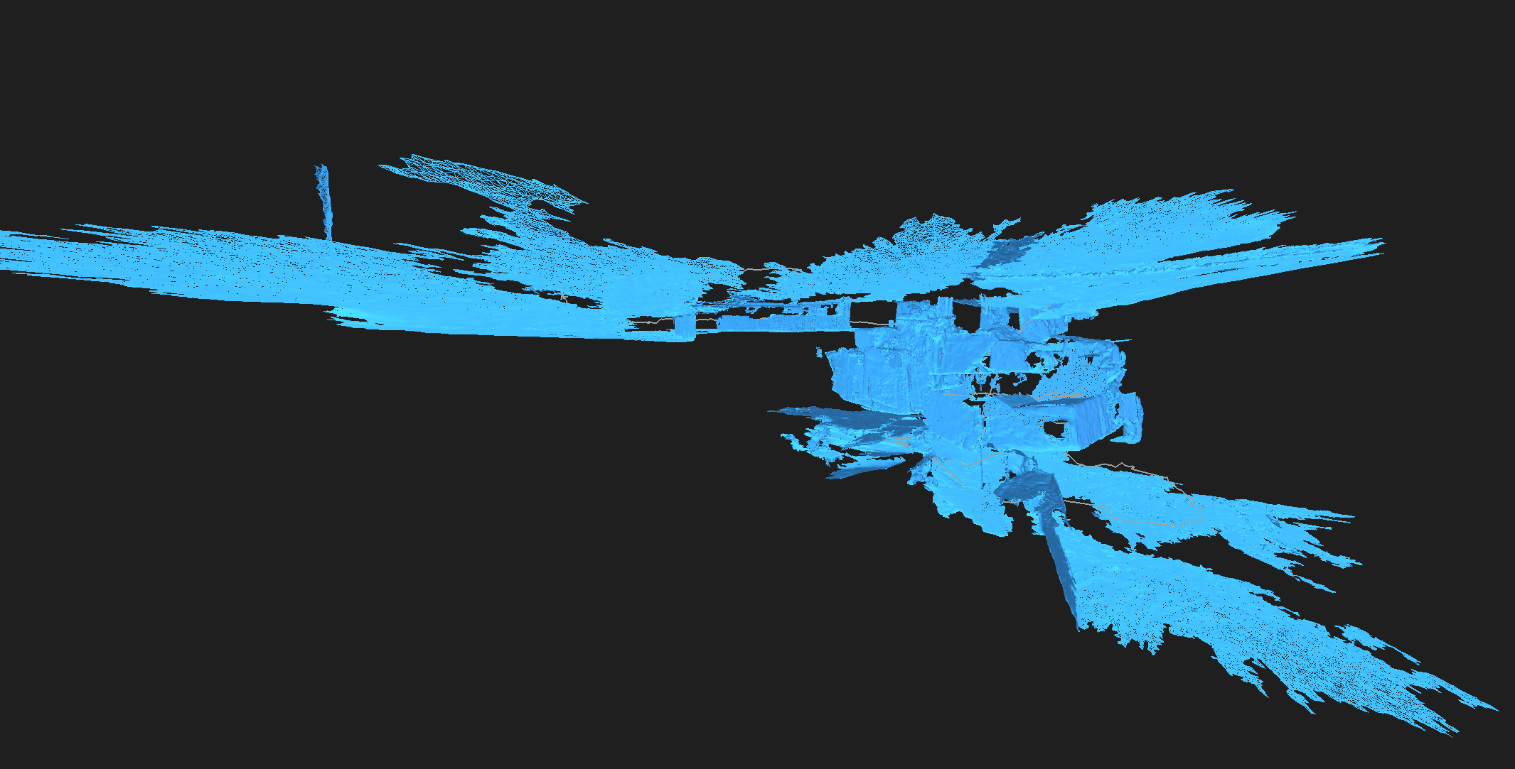
we are using the Zed 2i for 3D reconstruction in outdoor environments. When we load the SVO File into the ZEDfu tool, it initially produces a promising first reconstruction. However, the issue appears when there is a viewpoint overlap with a previously mapped area, and it gets even worse when we have loop closure. The tool automatically interprets this as a floor below the previously observed one, resulting in a mesh similar to what you can observe in the attached image. In the image, the upper and lower parts are supposed to be on the same level, but in this case, it appears as if there’s a difference of several floors. Does anyone have a solution for this? ![]()